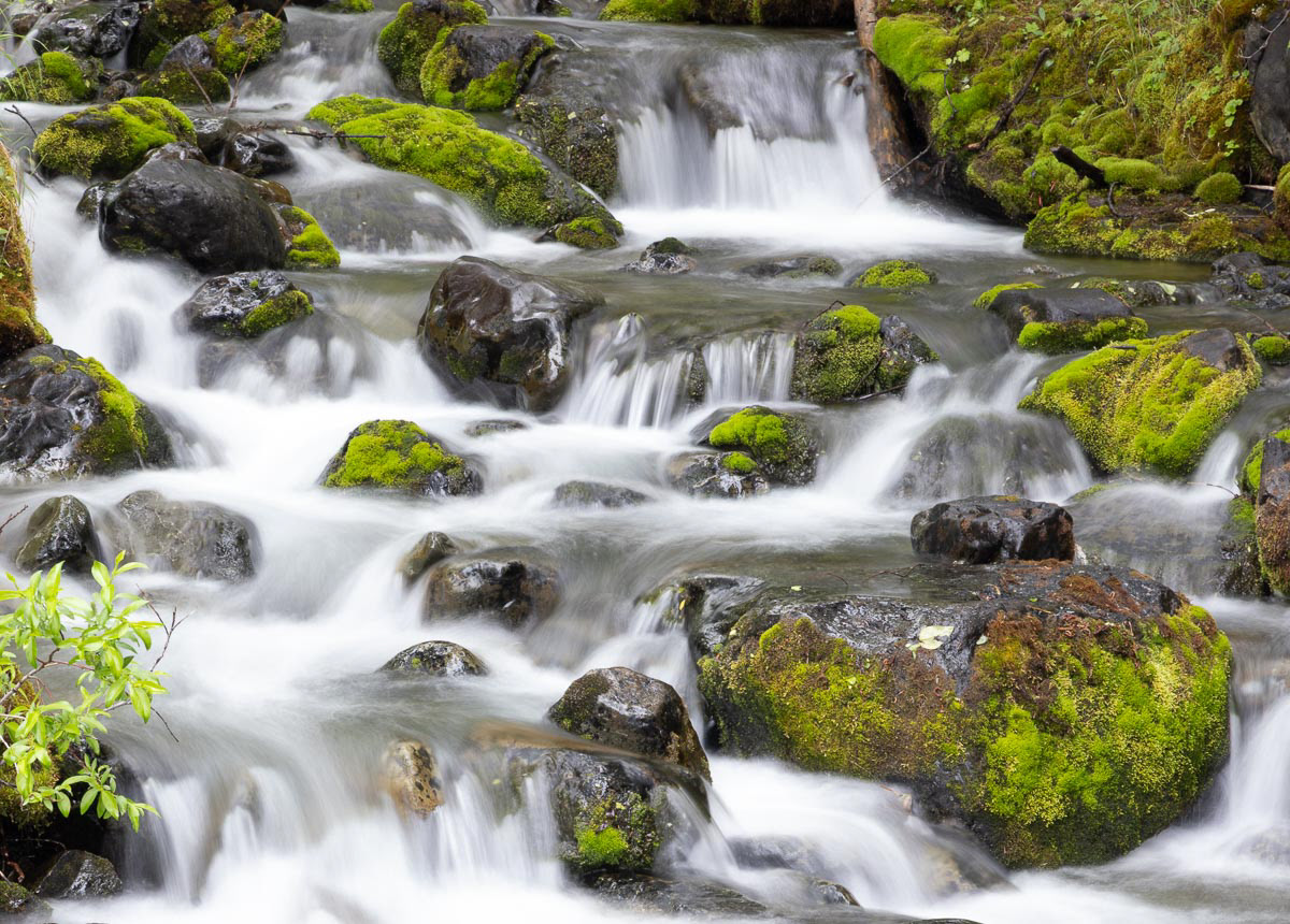
On my way back from McCarthy, I stopped for supper in Chitina. A local couple asked me to join them at their table. Over dinner they said if I liked waterfalls, I had to go to Valdez over Thompson Pass. I spent a rainy day traveling to Valdez, and the waterfalls were spectacular.
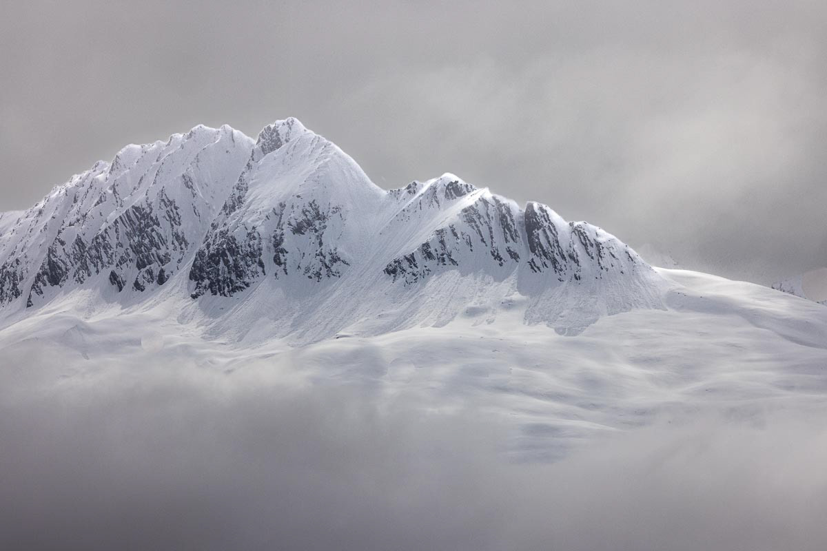
Still winter on Thompson Pass, 2,678 ft. elevation on June 7th. Ten miles later, I was in green, green hills and waterfalls on the way to Valdez.
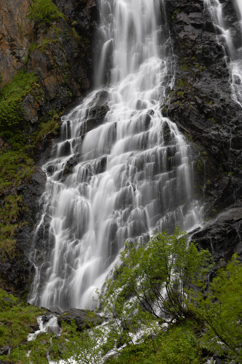
Bridal Veil Falls
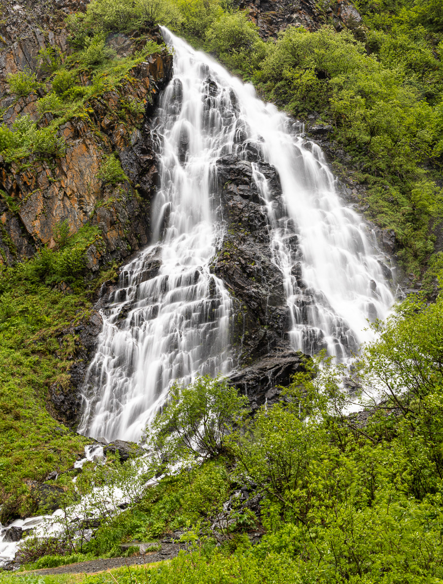
Horsetail Falls on Alaska Highway 4 to Valdez.
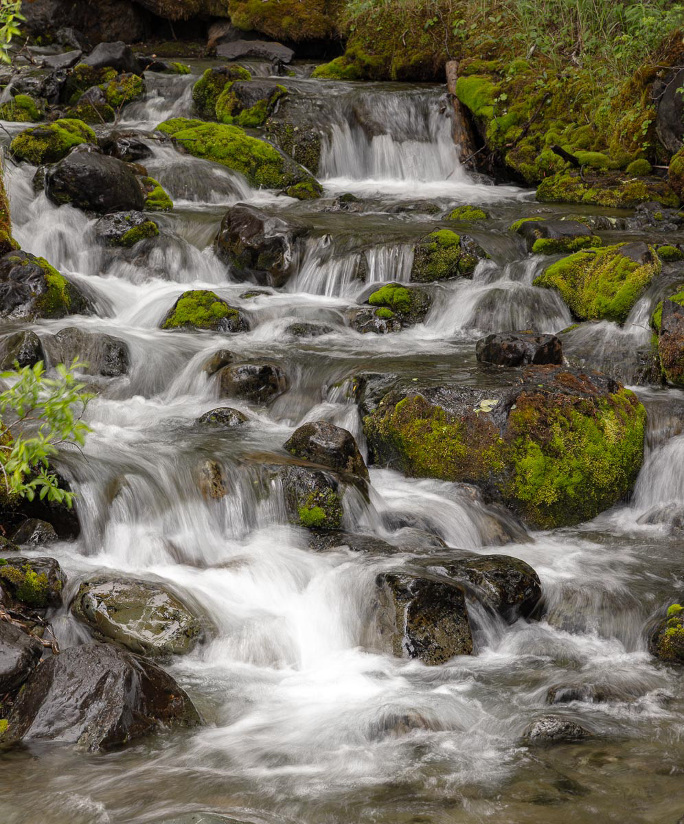
My favorite waterfall name -- Fall Creek Falls flowing into Eagle River.
The second week of my journey took me back to the Anchorage area where I based at the Girdwood Ski Area 50 miles from Anchorage. On the worse rain day of the trip, I visited the Alaska Native Heritage Center, When the weather cleared I photographed birds at the Anchorage Coastal Wildlife Refuge. And, of course, more hikes to waterfalls.
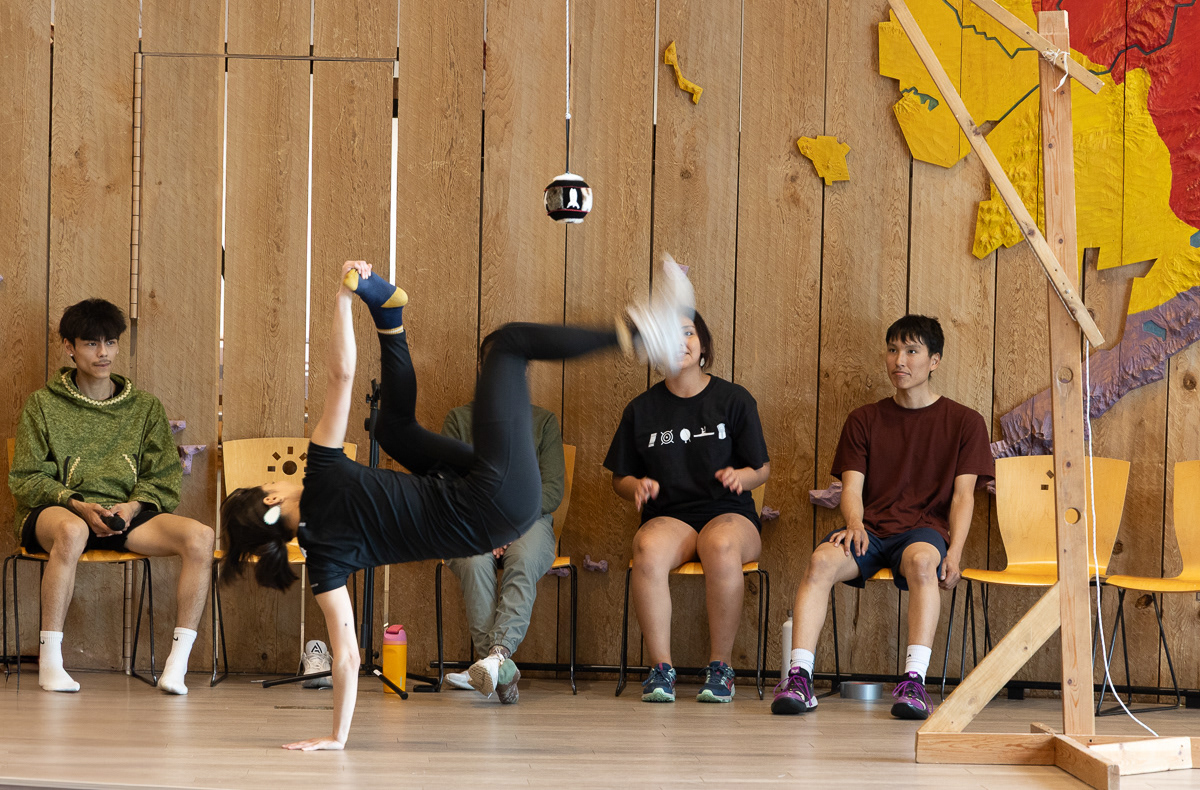
Students from the eight native associations in Alaska (see the colored map on the wall representing each native peoples area) intern at the Alaska Native Heritage Center each summer. They demonstrate native dances, artic athletic games and talk about their native villages and life. A must stop if you visit Anchorage.
Native dances typically had very limited foot movement since they originated in northern villages that were snowbound much of the year. Their communal houses where they danced were typically small and crowded during celebrations that involved dancing,
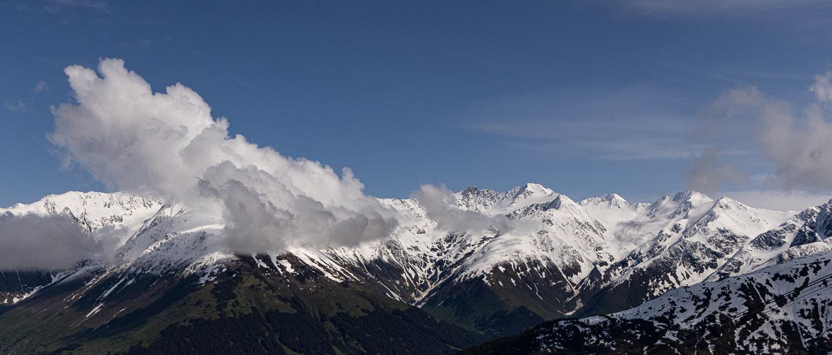
Chinstrap Peak, Centro Peak, California Peak and Bird Peak. View from the top of the Alyeska Aerial Tram at the Girdwood Alyeska Ski Area.
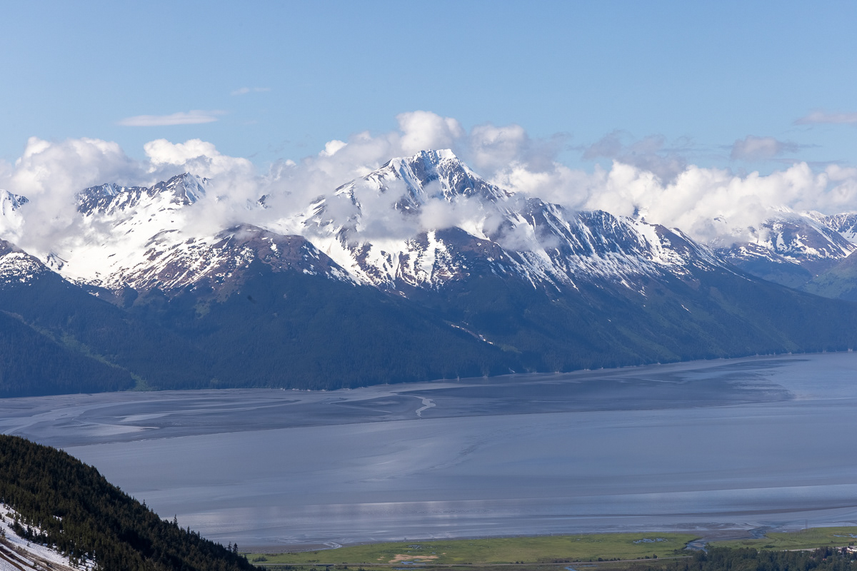
Turnagain Arm portion of the Cook Inlet. In 1778, British Captain Cook, looking for the Northwest Passage, sailed up the Arm until it dead-ended. He then had to "turn again" to sail back to the Cook Inlet and out the the Pacific. Tides up to 32 feet occur in the Arm.
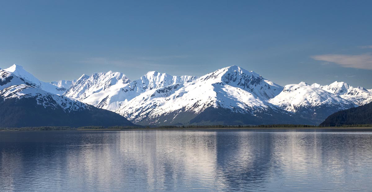
Turnagain Arm of the Cook Inlet when the tide is in.
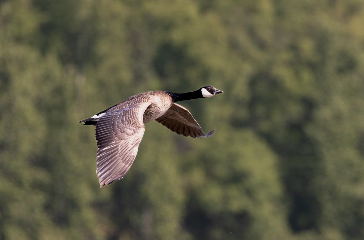
Canada Goose
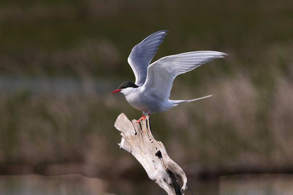
Artic Tern
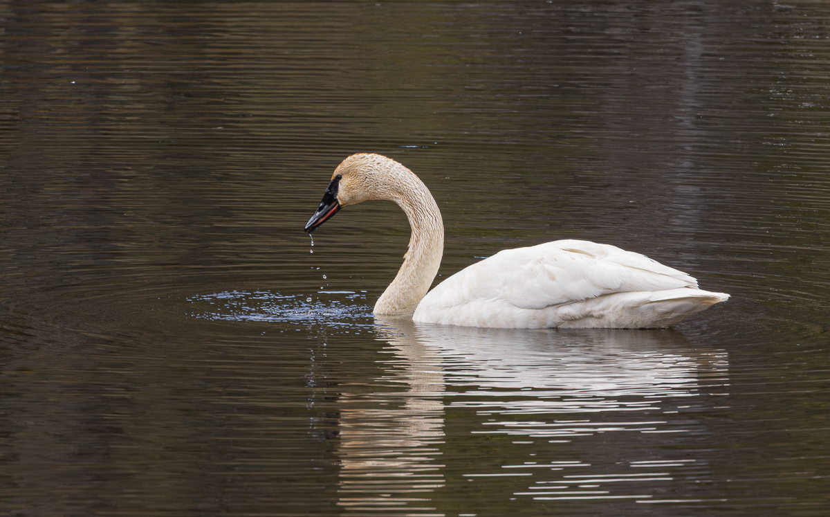
Tundra Swan
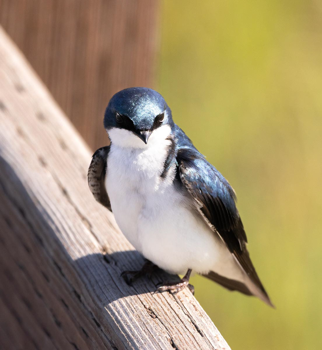
Tree Swallow
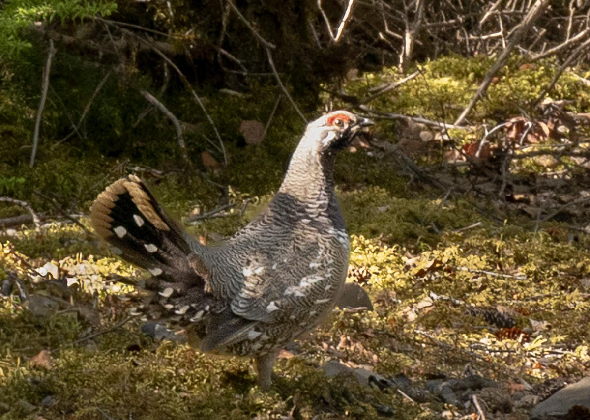
Spruce Grouse seen on the way to Bird Creek Falls.
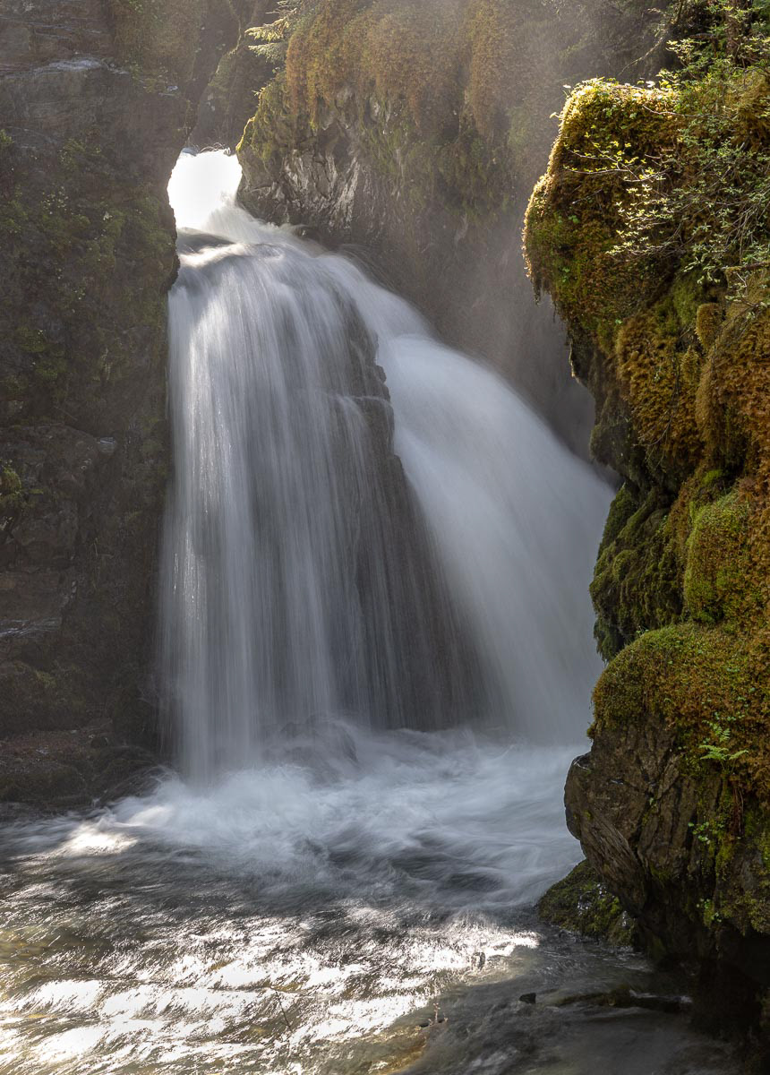
Bird Creek Falls was my toughest hike -- lots of flooded creeks to wade through, steep descent to the falls, almost lost my glasses.
Virgin Creek Falls.
I drove to Whittier, Alaska hoping to take a cruise on Prince William Sound to photograph sea lions and puffins. However it was the opening week of fishing and the cruise boats were all booked. I hiked Horsetail Falls Trail which took me high above Whittier with terrific views of the Sound, the city and surrounding mountains. The best sea food dinner in Whittier topped off a hard, but wonderful day.
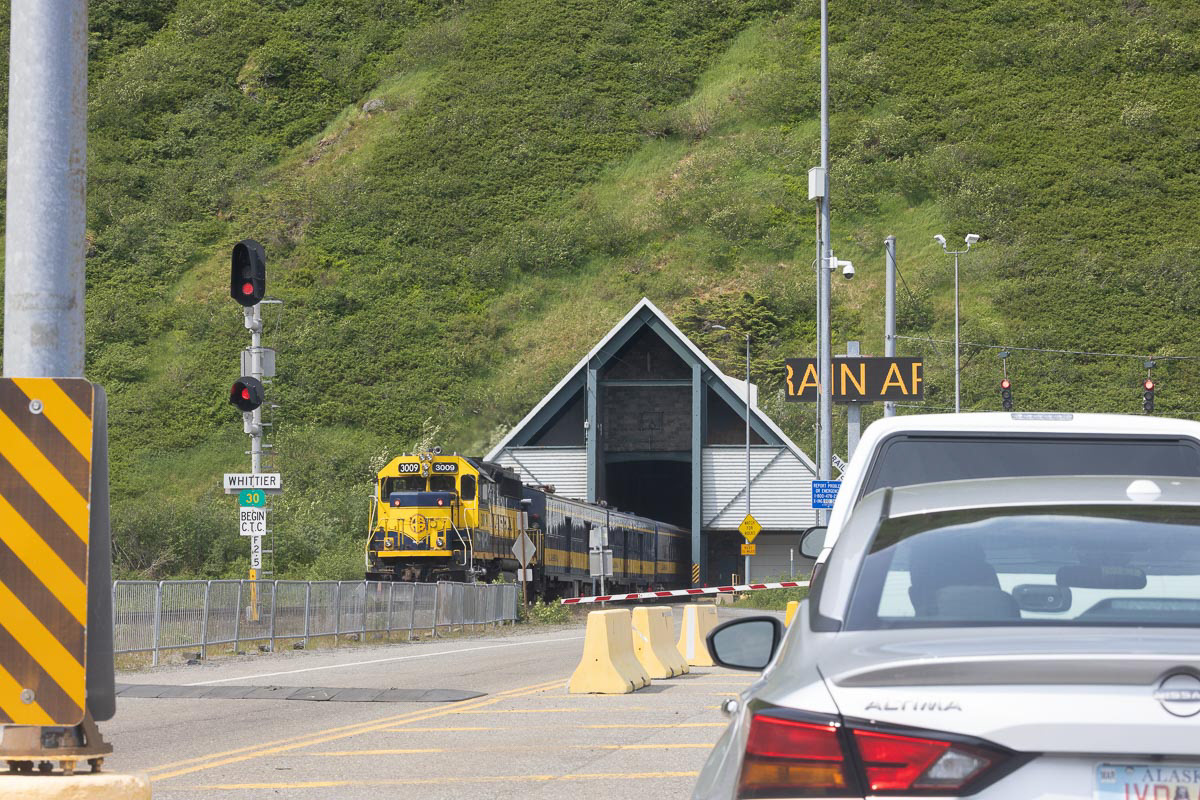
Now to get to Whittier, one must drive through the Whittier Tunnel (Anton Anderson Memorial Tunnel) for 2.5 miles. Trains have priority access, then cars and trucks. Cars are spaced 30 seconds apart and the speed limit is 25 mph. In this photo, I am waiting in line for the train to clear the tunnel. The next video is driving through the tunnel.
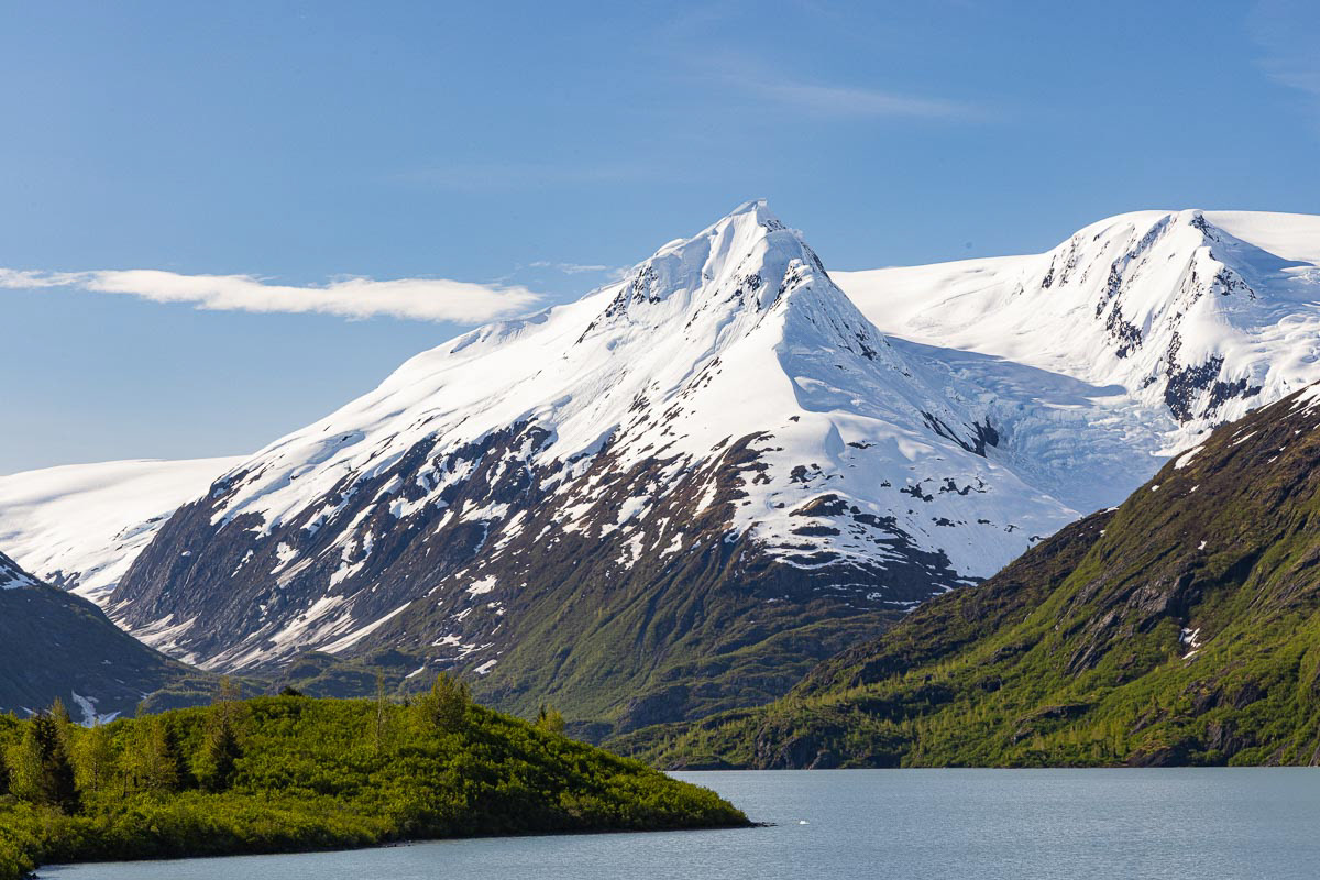
Portage Lake with Bard Peak and Shakespeare Shoulder above. Portage Lake is just before the Whittier Tunnel.
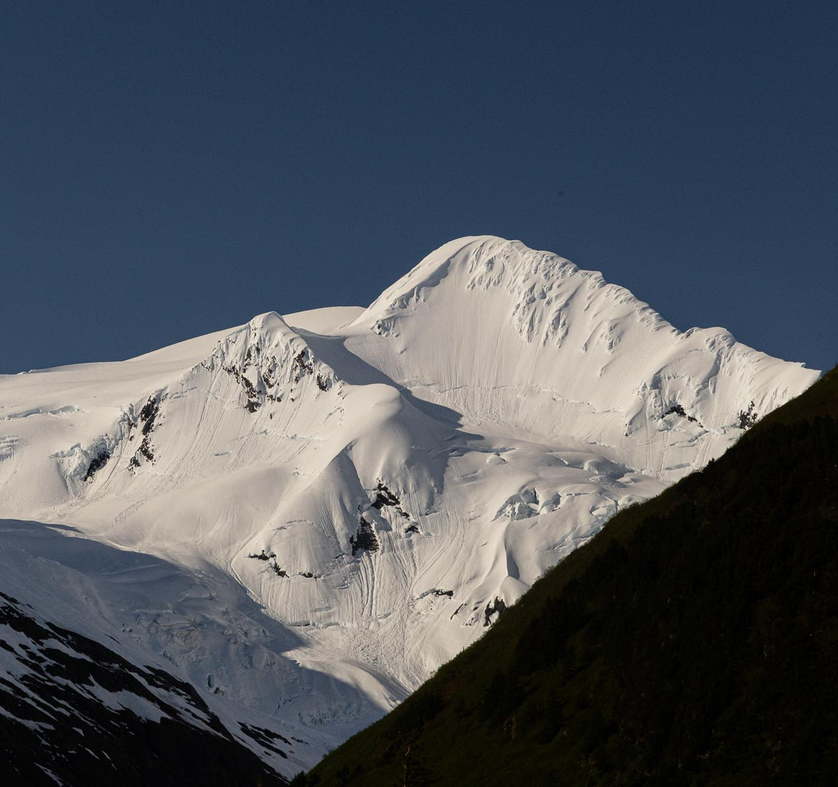
Maynard Mountain and Lowell Peak (4,728 ft.) across Prince William Sound from Horsetail Falls Trail.
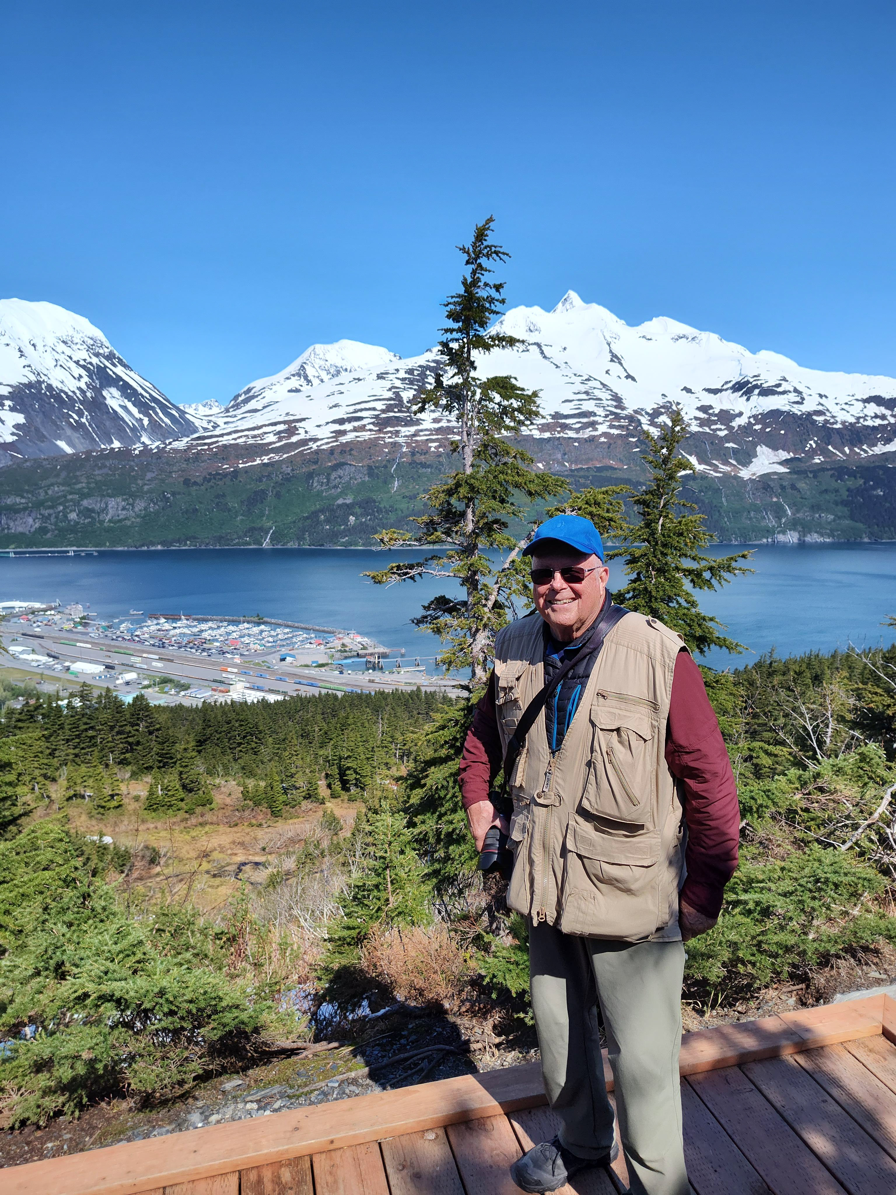
A family from Michigan celebrating a family reunion off a cruise ship was nice enough to take my photo at the top of the trail. Whittier appears close in the background, but it is 4 miles away and 2,000 ft. lower.
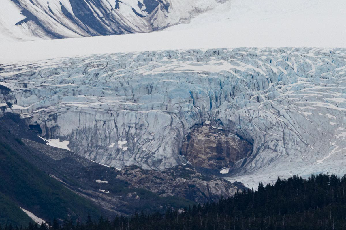
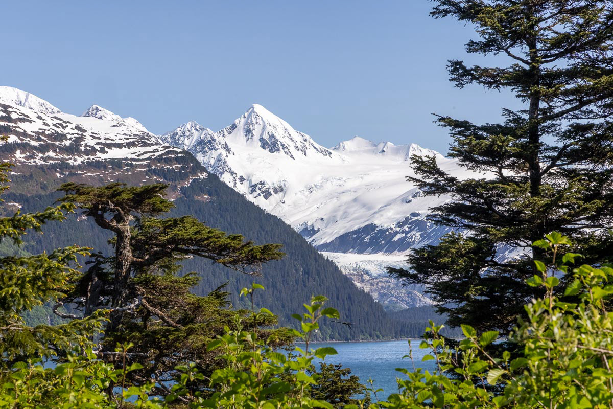
Hubbard Glacier a long, long, l.......ong way across Prince William Sound from Whittier. Telephoto lenses are fun.
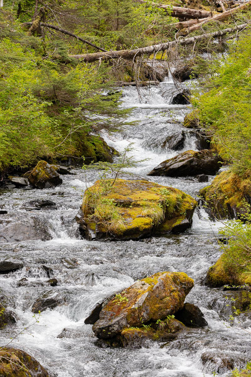
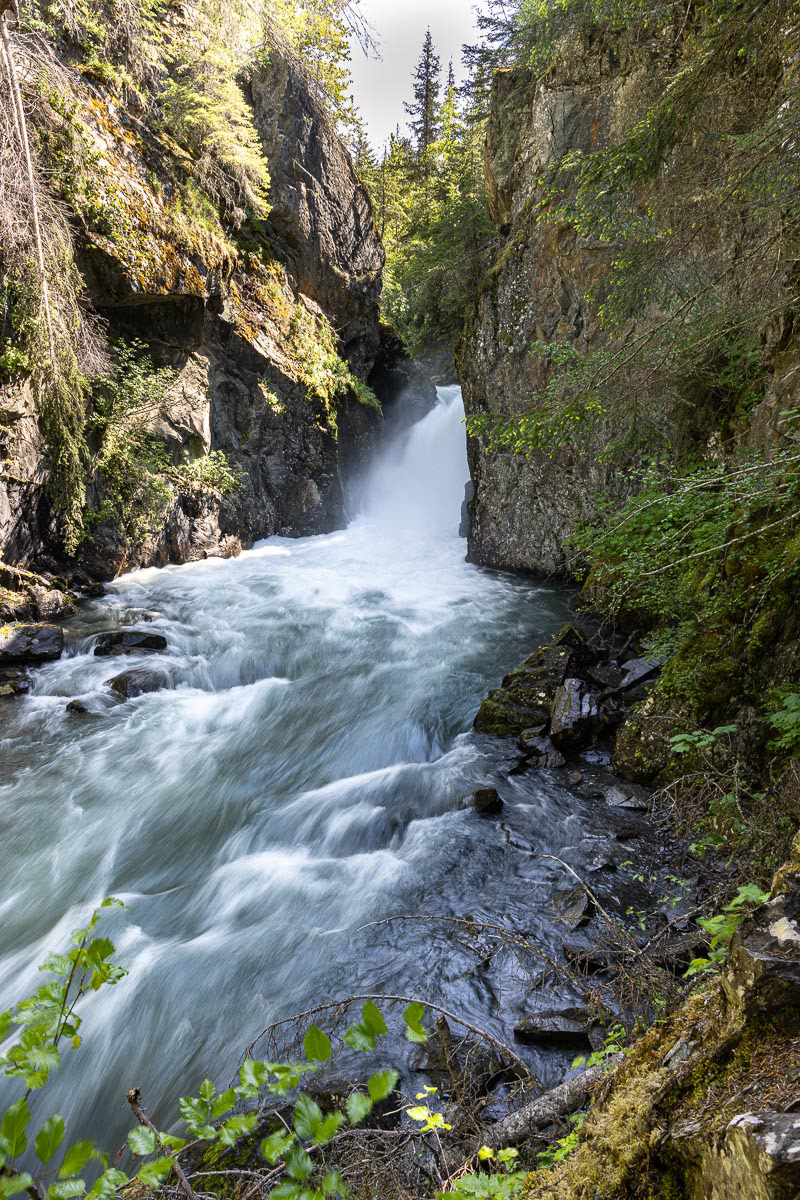
Cove Creek Falls a short hike outside Whittier. Are you keeping a waterfall count?
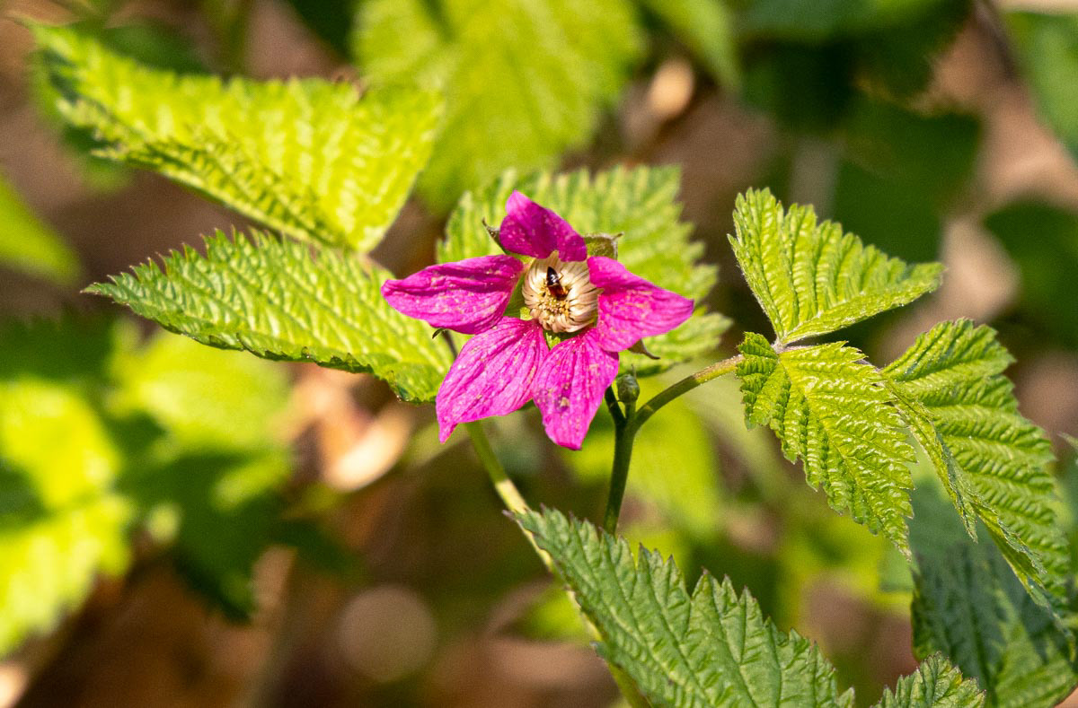
Salmon Berry flower. Salmon Berries were probably my most frequently encountered plant. No wonder there are so many bears in Alaska.
Backside of Shakespeare's Shoulder Mountain taken from the Whittier side. For some reason, this is one of my favorite photos from the trip.
I only had one day, toward the end of the trip where the weather was cold AND wet AND windy, so I stayed in the Girdwood condo and rested. I still had not seen a photographable moose and several folks said a moose siting was a sure thing on the Petersville Road off Parks Highway 3 on the way to Denali National Park (no one in Alaska calls it Mt. McKinley, by the way). On my second-to-last day I traveled north to try one more time to photograph a moose. Alas, no moose. However the consolation were spectacular views of Mt. Denali.
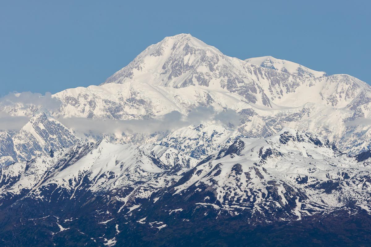
Denali from Denali Viewpoint Park
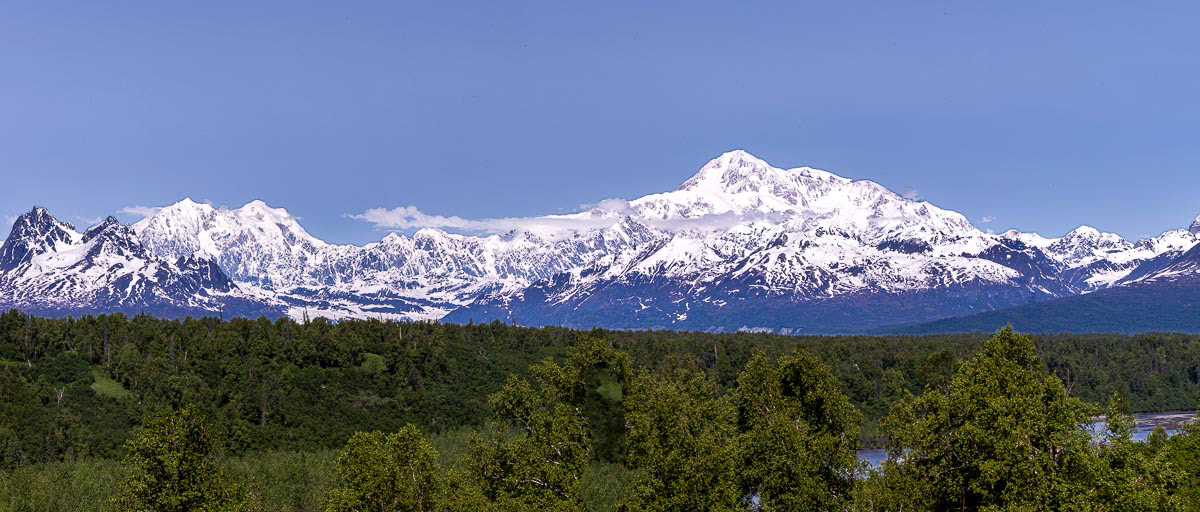
Right to left -- Mt. Foraker (17,400 ft), Mt. Hunter's three peaks (14,574) and Mt. Denali (20,320 ft.) Mt. Foraker is taller than Hunter, it is just closer in this view. The Susitna River is in the foreground.
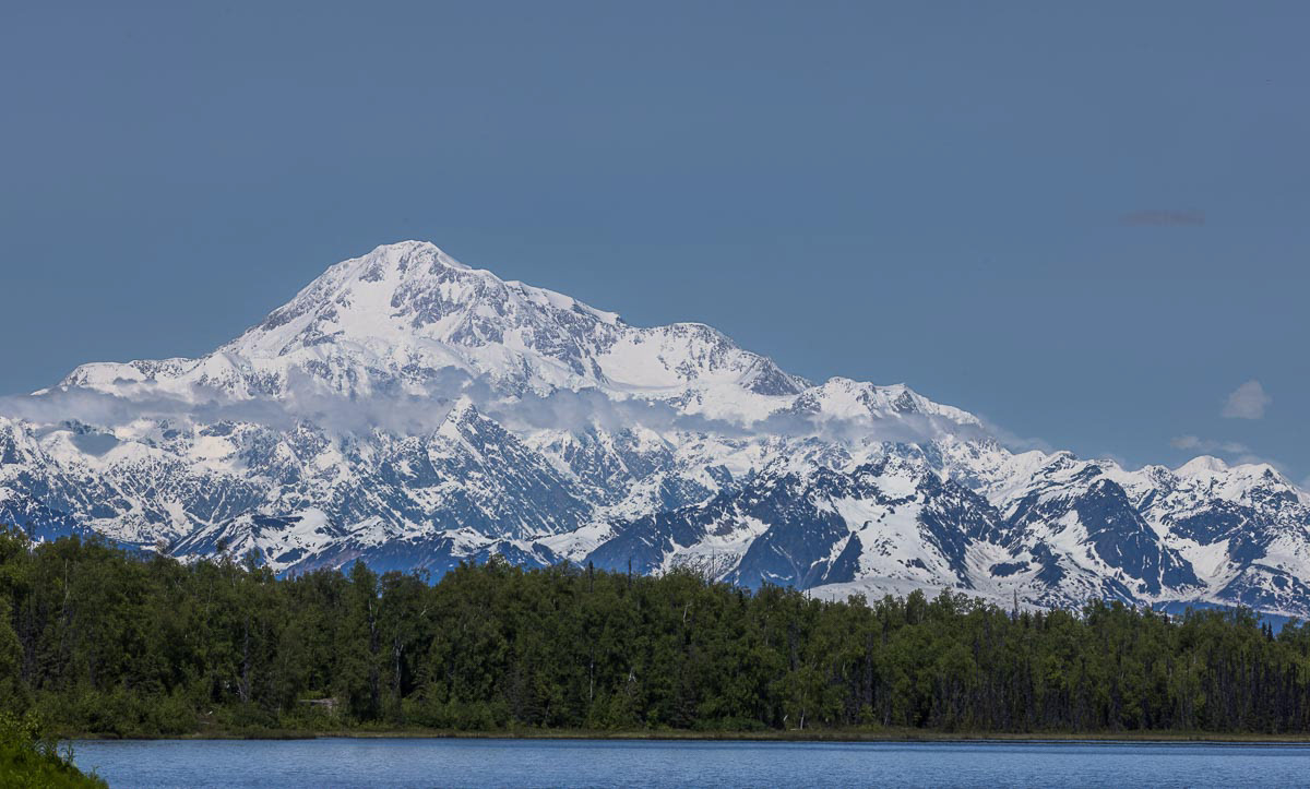
Denali from Scotty Lake on the Petersville Road. When Nancy and I traveled to Denali National Park in 2009 for a photo workshop, we told Denali only appears out of the clouds 20% of the time. l feel fortunate to have seen the peak on both trips to Alaska.
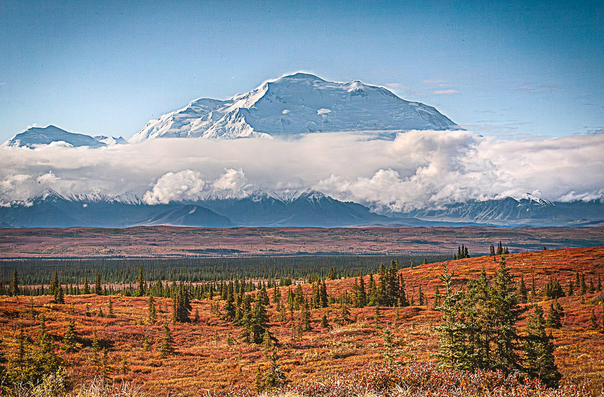
As a comparison, this is Denali in the fall of 2009 taken from the end of the Denali National Park road.
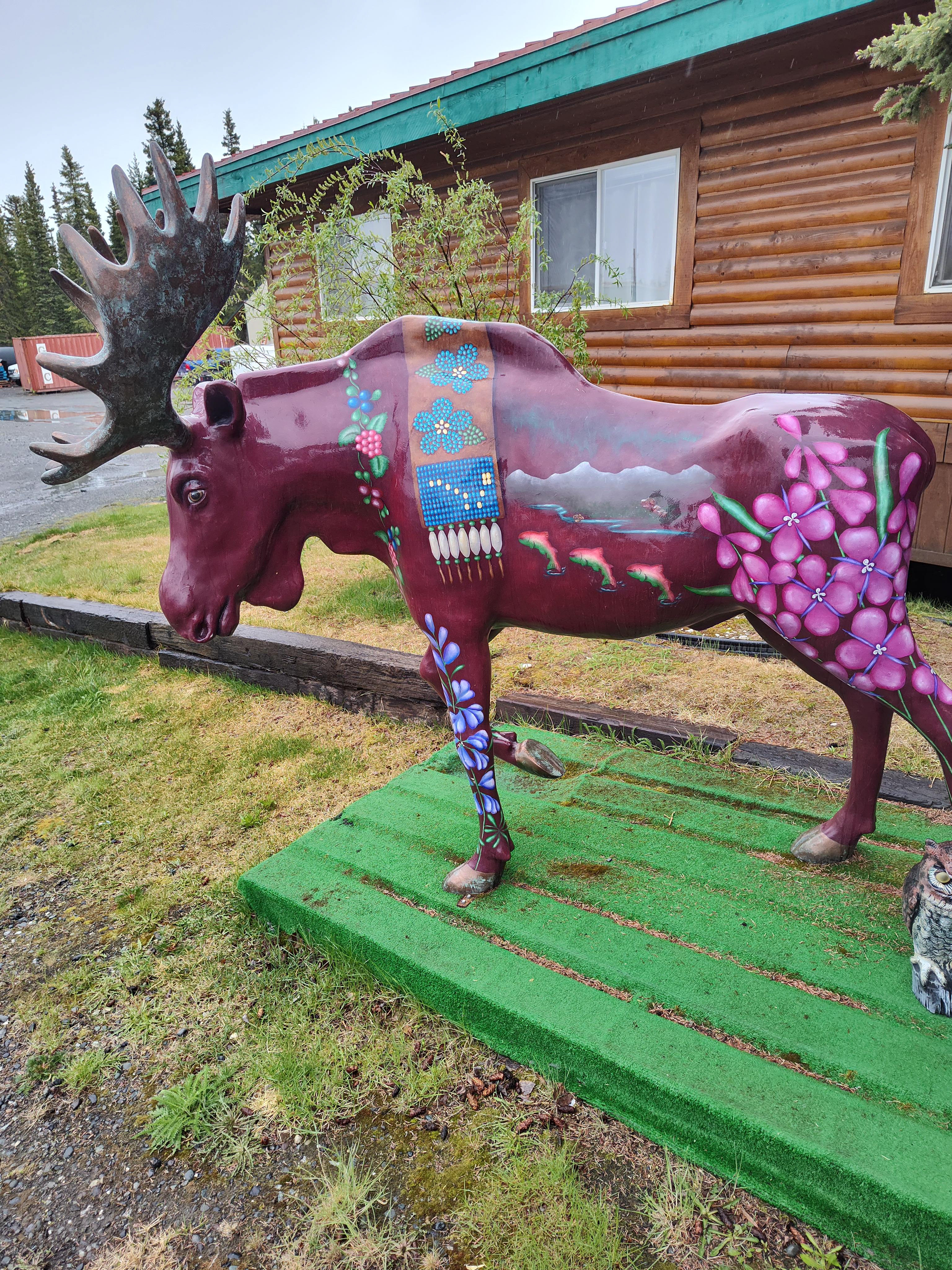
The only moose that I saw that would stand still long enough for a photo.