"I am too old to learn anything new."
"Well, get over it, Dad, we bought you a drone for Christmas."-- Love, Kevin and Jed.
On second thought, if we stop learning and challenging ourselves, no matter how old or how young, what's life about anyway? So here are my first attempts at drone photography. Kevin told me once, "A drone is just a 200-foot tripod." And there are lots of times I have wished I'd had 200-foot tripod.
To be completely honest, flying this drone mak2es me nervous, but Kevin and Jed say that is good because that makes us careful and cautious. Kevin's drone motto is ABA (always be afraid ). But then I see the photographic results and I can't wait to fly again.
So mostly unedited, here are my first attempts with this new photographic tool.
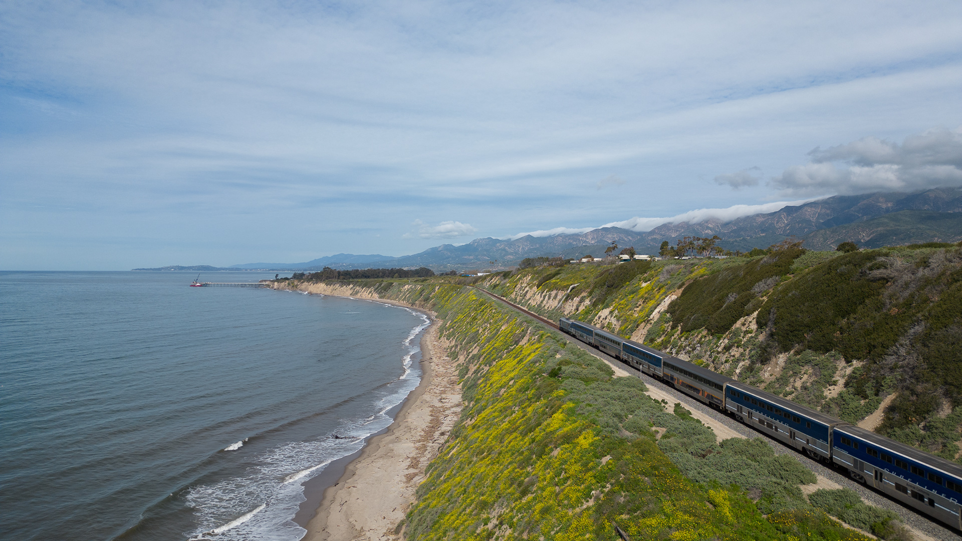
This was taken on my second flight. This is the California Surf Liner (Commuter Train) just south of Carpinteria near Rincon Point, a famous surfing spot. Kevin is my instructor and co-pilot.
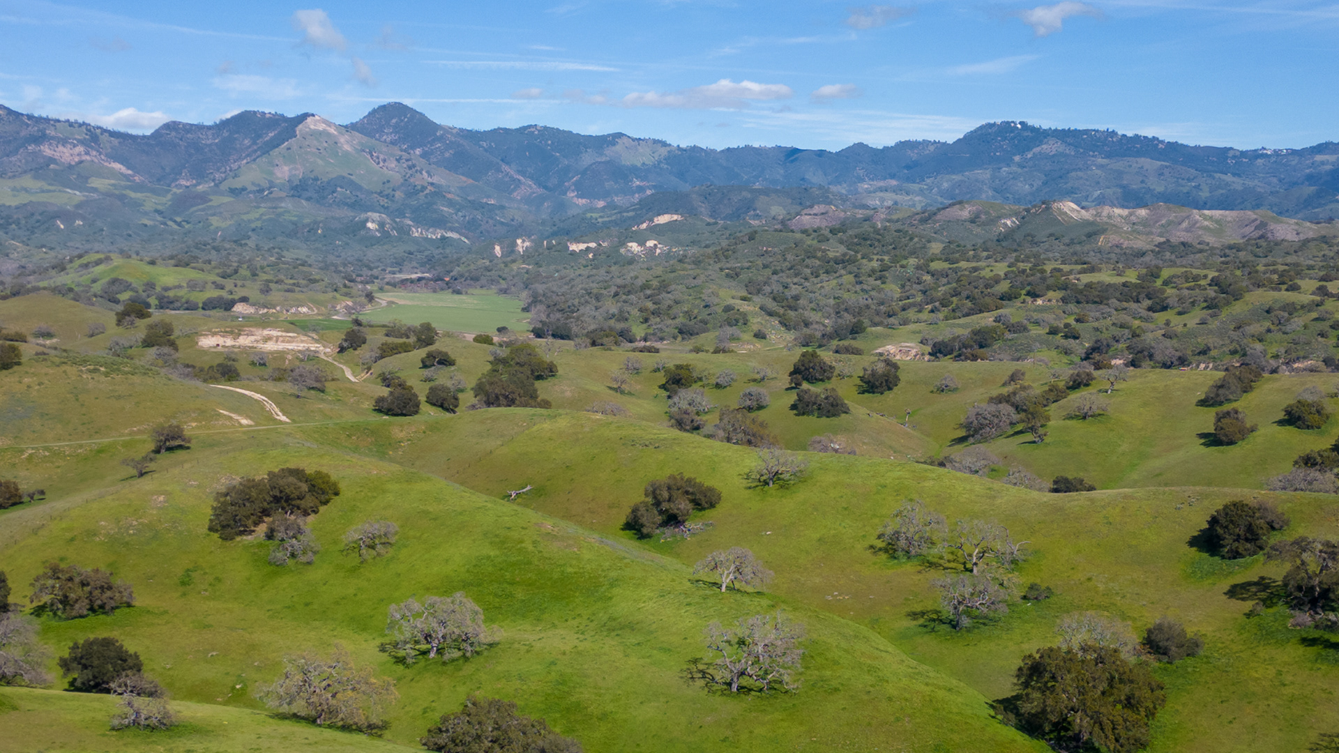
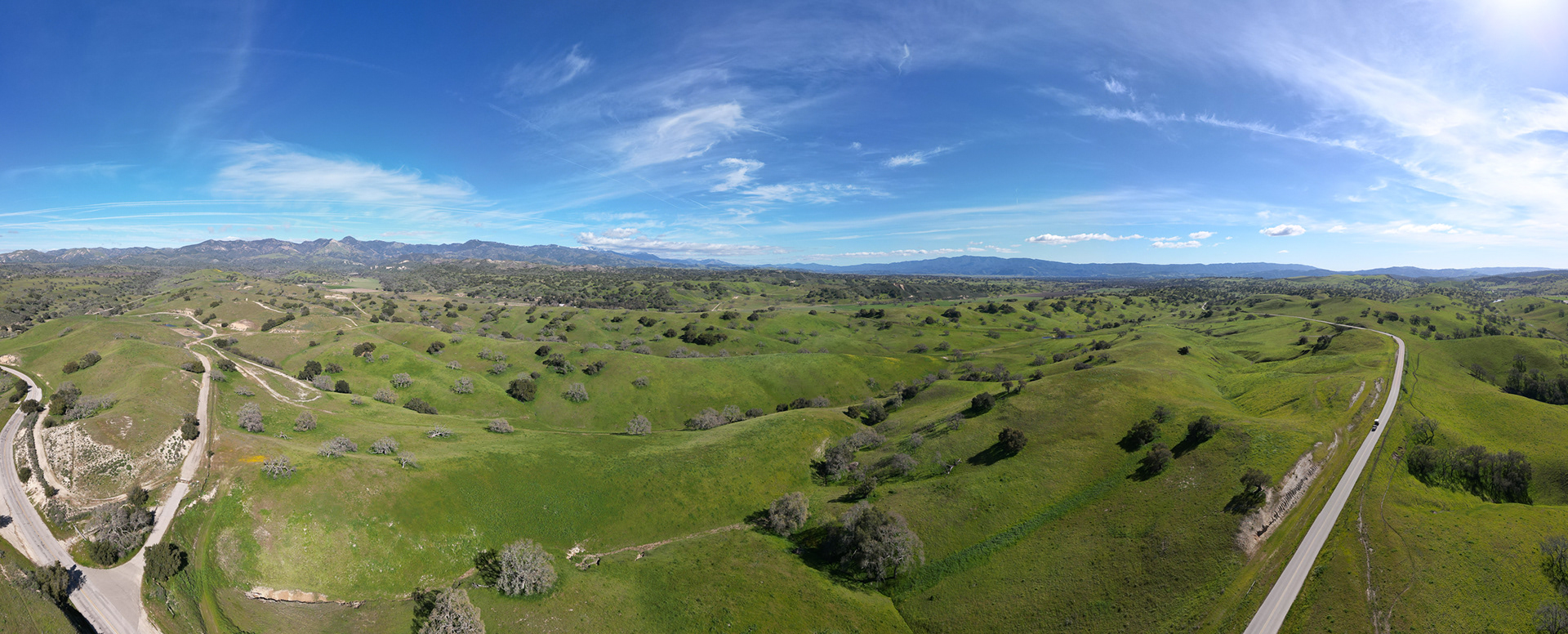
My third flight -- just north of Los Olivos looking east toward Figueroa and Grass Mountains. This is a panorama shot and produced automatically by the drone camera.
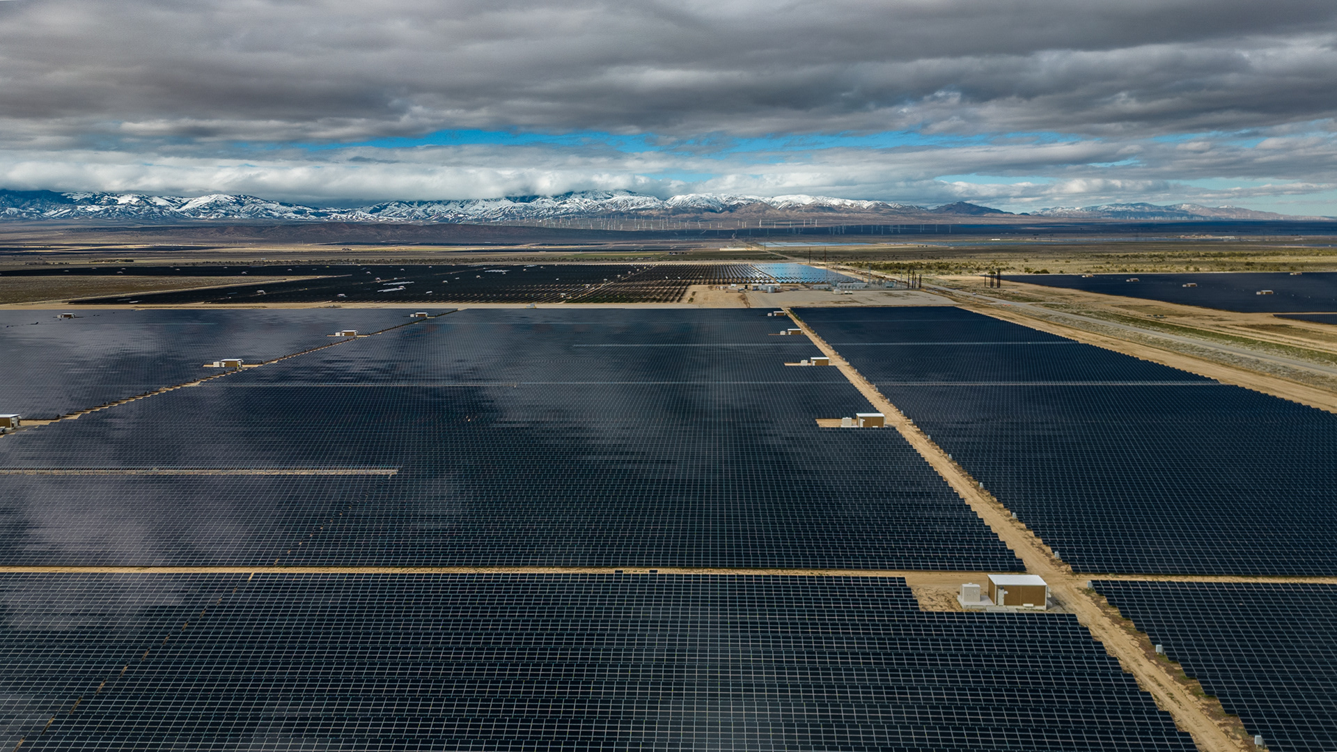
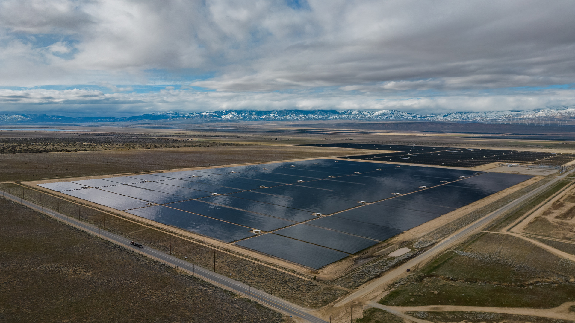
West of Palmdale, CA (home to Edwards Space Force Base north of LA). This is near the Antelope Poppy Preserve which we were checking out for flower bloom progress in late February. The poppies were not out yet, but the acres and acres of solar panels and wind turbines (in the distance in the top photo) were doing their thing. It was a good area to practice with the drone.
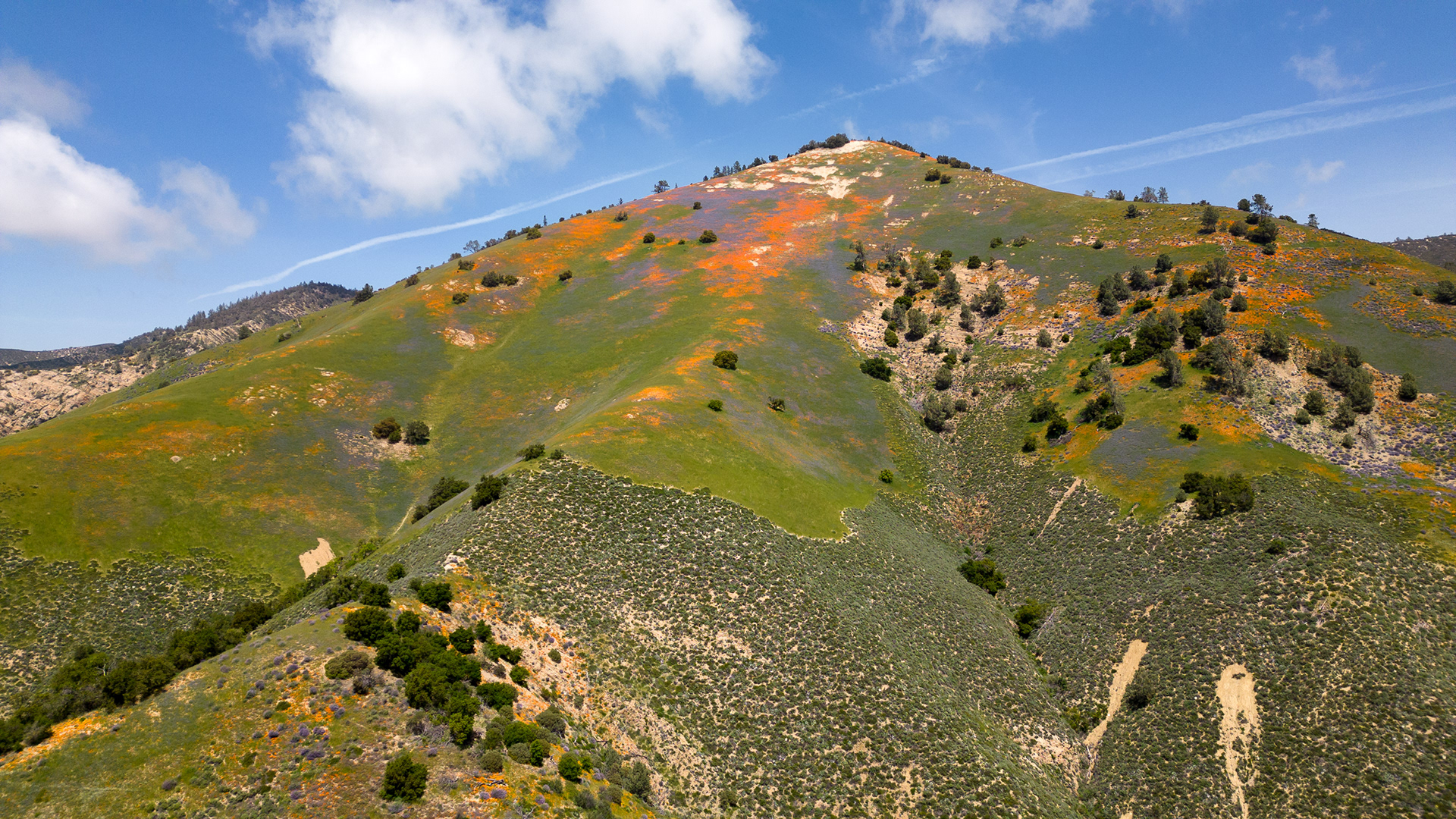
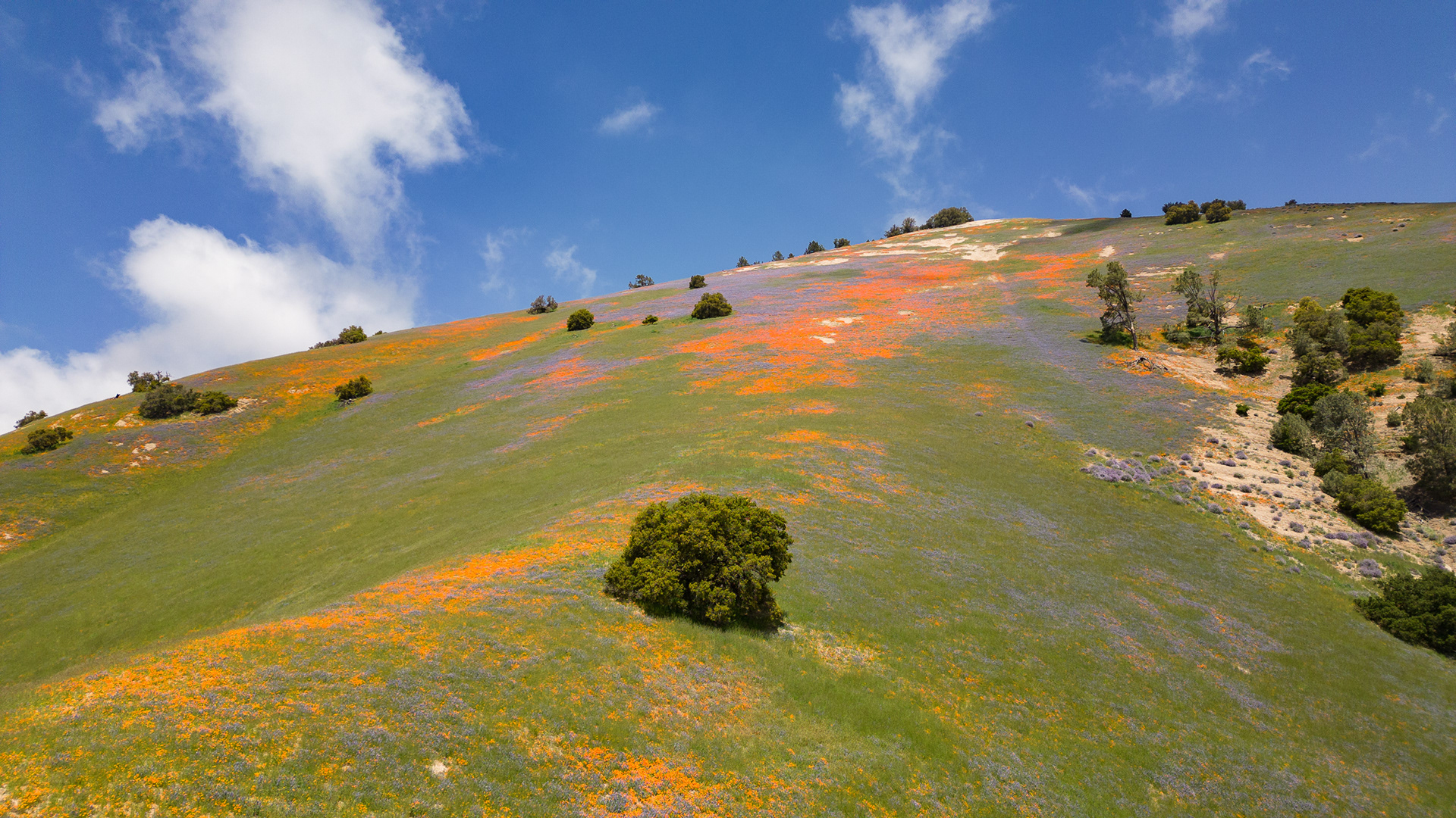
We pass Grass Mountain on our way to Figueroa Mountain (see separate gallery page). But it is always 2-3 miles away from the Fig. Mountain road, so all one sees are splashes of poppy and lupine color in the distance. You can hike up Grass Mountain, but it takes more than half a day. I decided to see what the drone what do. My first flight without Jed or Kevin at my side -- nervous, nervous.
And ---- rookie mistake, I had my maximum altitude set to 400 ft. (measured from the take-off point) and Grass Mountain was more than 1,000 feet above the take-off area. Thus, I quickly learned if I kept flying north, I would fly into the mountain. Next time.......
My video footage (see three photos below) documents the flight. This footage is herky and jerky and not smooth at all -- so practice, practice, practice. But the still images turned out nicely. It was fun to have a "two-mile tripod" in this instance and not have to hike up the mountain.
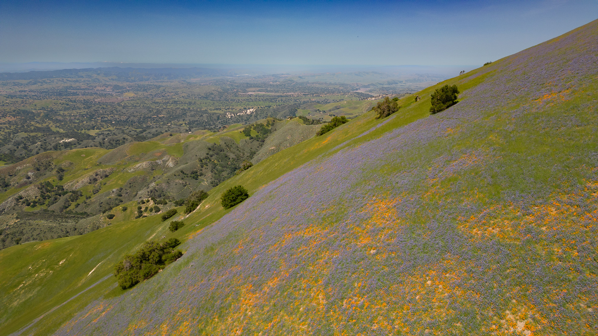
Yikes -- don't fly into the mountain. My take-off point is the road on the distant ridge seen at the end of the video.
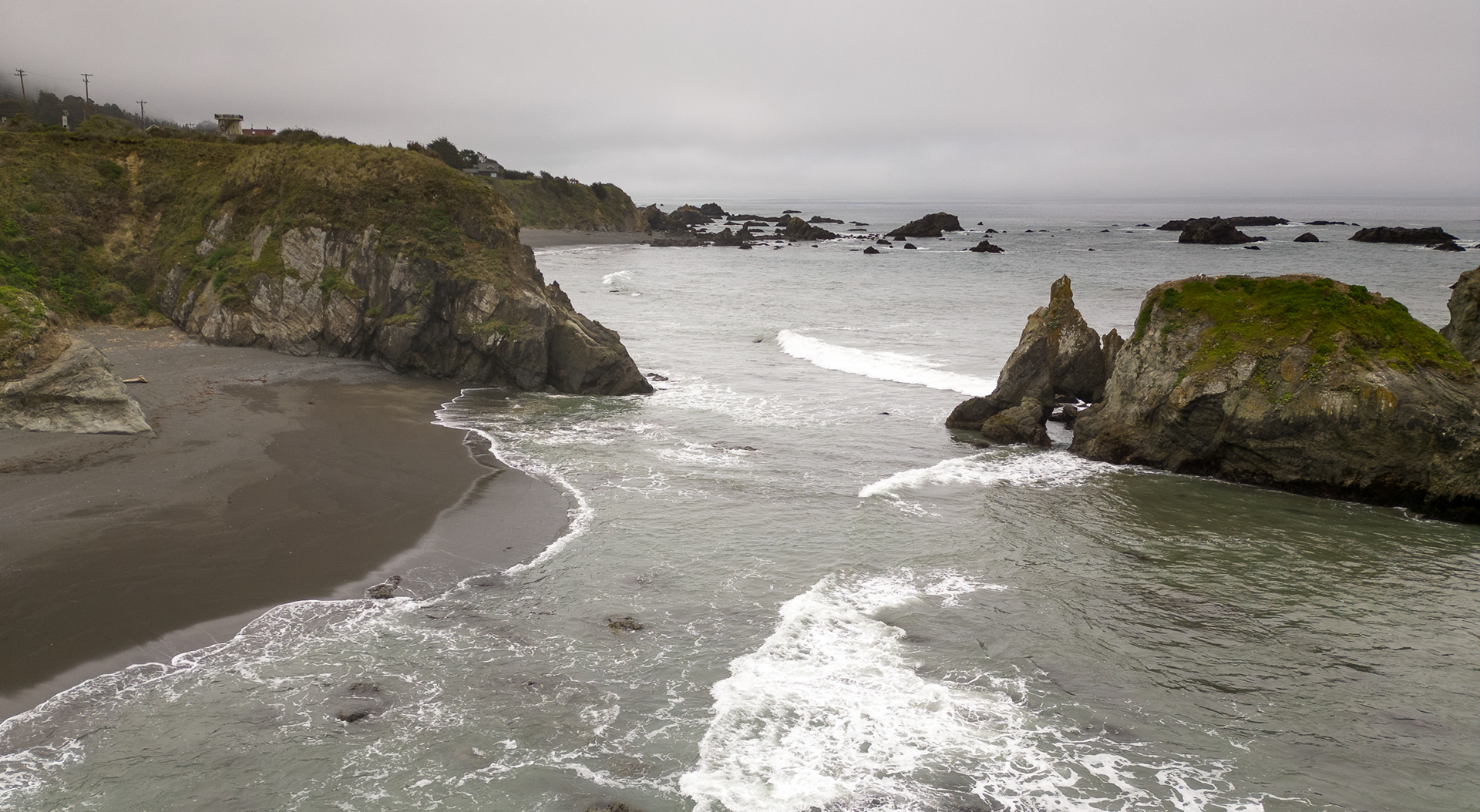

As we traveled north from Carpinteria to the redwoods in early May, we diverted off Highway 101 to be closer to the coast. North of Fort Bragg the day was perfect for attempting my first drone flight out to sea stacks. Notice the gulls on top of the stacks. I kept my altitude high enough so as not to disturb the birds and succeeded as they never budged during the entire flight.
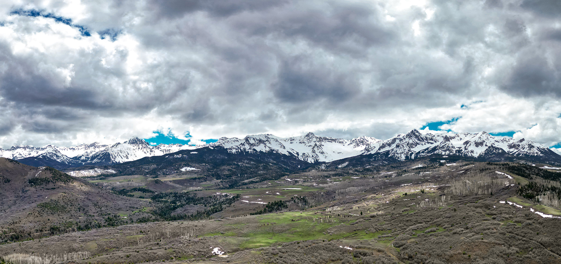
Upon returning to Montrose, I could not resist flying the drone at the iconic Dallas Divide photo site on the road between Ridgway and Telluride. I goofed up using the drone's in-camera panorama capabilities, so I made this panorama from six still images taken with the drone and stitched them together in Lightroom software. I cannot wait to drone this scene later in the summer when all the aspen are green and again in the fall. Stay tuned, hopefully....