In June of this year, I was fortunate enough to travel to Alaska for two weeks. Nancy and I had journeyed to Alaska in 2009, and were thrilled with visits to Denali National Park, Seward, Homer and a float plane visit to the Katmai National Park for bear viewing. In recent years, I had become enthralled with the non-fiction books by Tom Kizzia (Cold Mountain Path and Pilgrim's Progress) and the Alaska fiction writer Dana Stabenow. They both wrote wonderful books about McCarthy, Alaska and the formation of Wrangell-St. Elias National Park. This area was the first week focus of my visit, although I was also able to visit Chugach State Park (largest state park in U.S. and larger than Rocky Mtn. NP in Colorado), Whittier, Girdwood, and the city of Anchorage.
Alaska deserves more than two weeks or even two years. There are 12,000 named rivers and streams and more than 20,000 named and unnamed mountain peaks.
I have divided my photos into two galleries, Alaska Wee One and Alaska Week Two.
I probably spent too much time looking for moose, one of my photographic objectives. There are 1,200 moose living within the city limits of Anchorage and I hiked many miles in their parks and open spaces without seeing any. In the spring moose, deer and elk are hiding with their newborns and not active. Fall would have yielded better results.
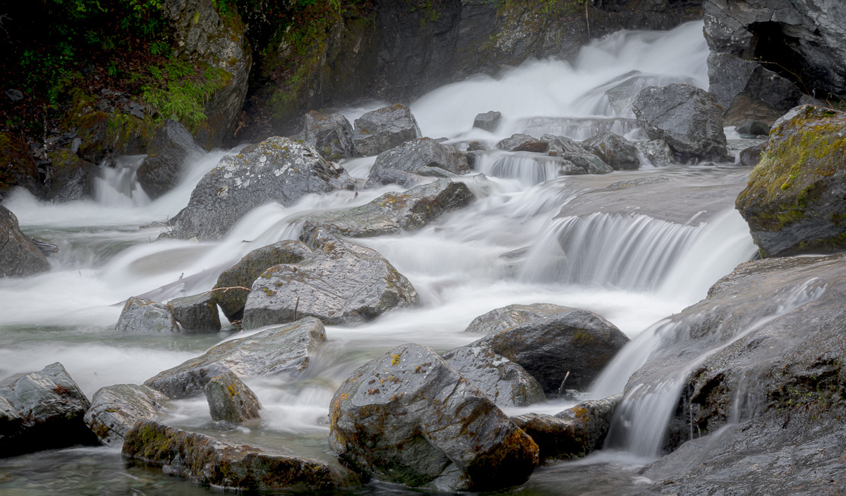
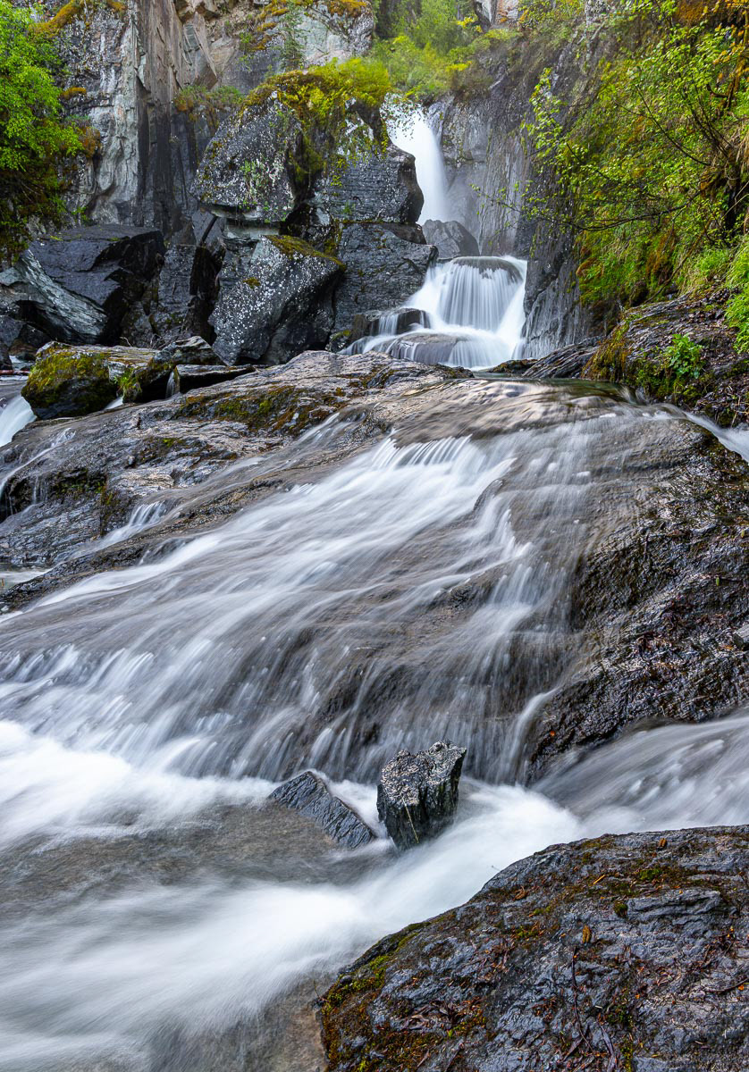
I love to photograph waterfalls and spring is the best time to find them rushing full. Whenever I had rainy or foggy weather, I switched to hiking to waterfalls.
As I identified plants on these hikes, I noticed many of their names ended in "berry". I realized I was seeing the flowers of these plants and that bears are not interested in the flowers as much as they are the berries which appear later in the summer. I did carry bear spray, but had no need for it. Also, even the rainy, cloudy days were not cold (50-60 degrees). At several locations, I was above 3,000 ft. in elevation and those areas still had ice on pond edges and some vegetation had not greened up yet. Still beautiful.
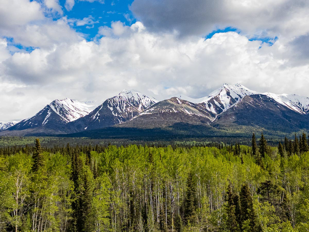
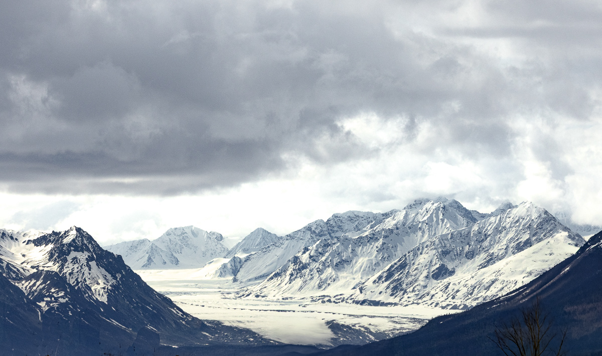
Wrangell Mountains from the McCarthy Road
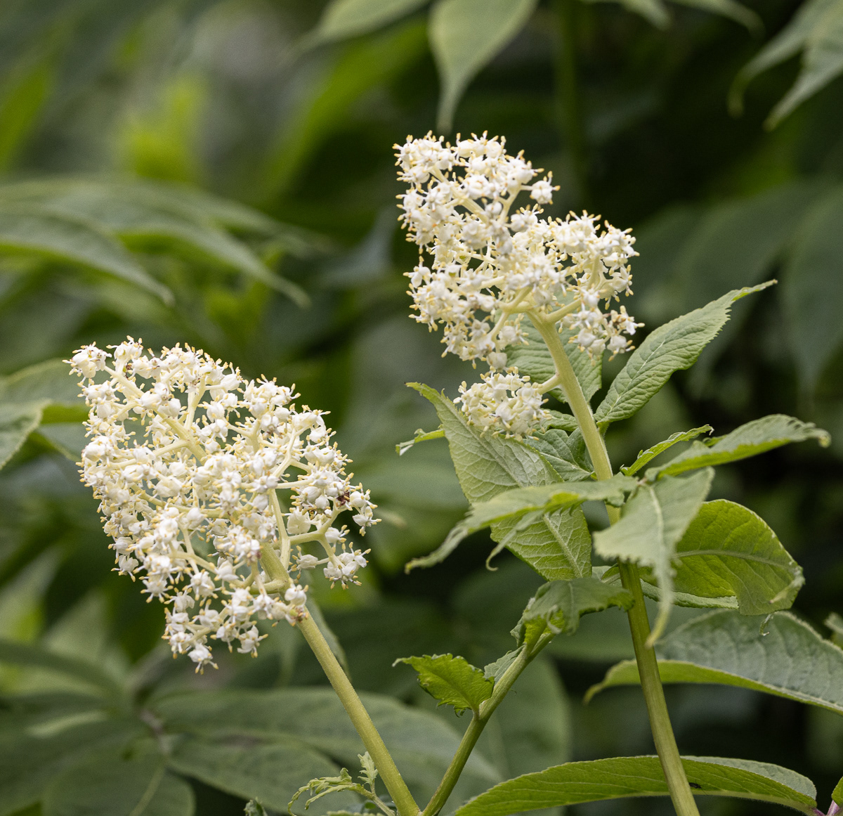
Red Elderberry flowers.
Campbell Creek Estuary Trail
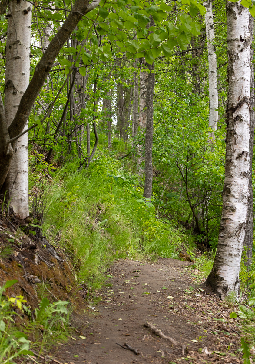
Trail to Thunderbird Falls.
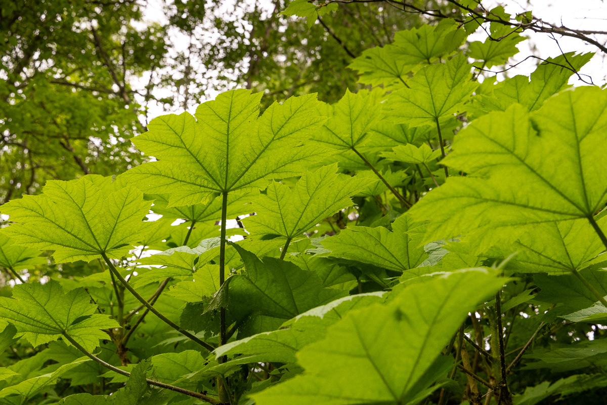
Giant thimble berry leaves, one of the most predominant plants on my hikes. Salmon berries were the second most populist plants along the trails.
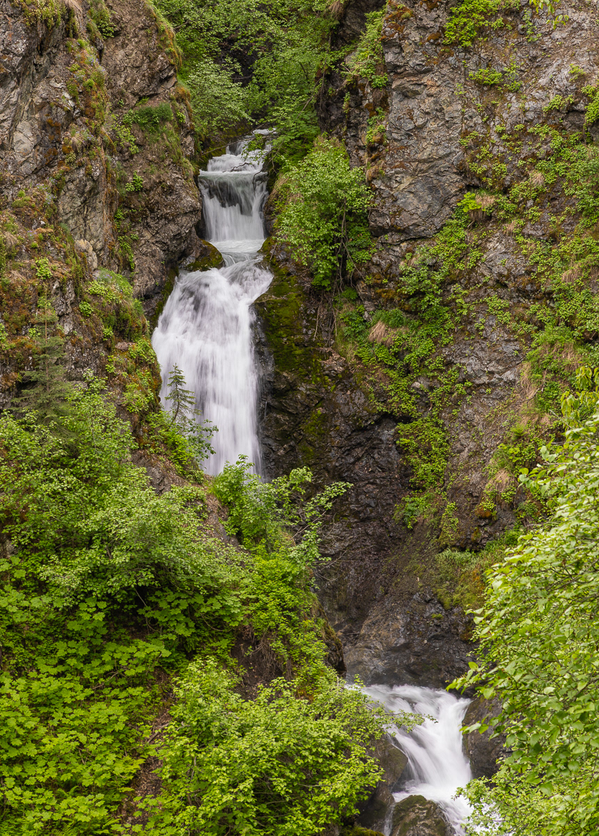
Upper and Lower Thunderbird Falls, Chugach State Park

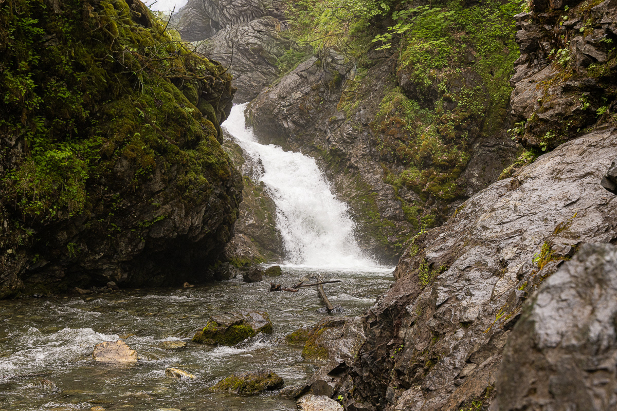
South Falls, Chugach State Park
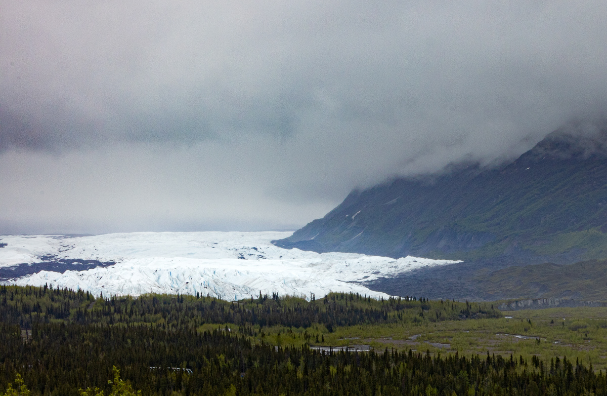
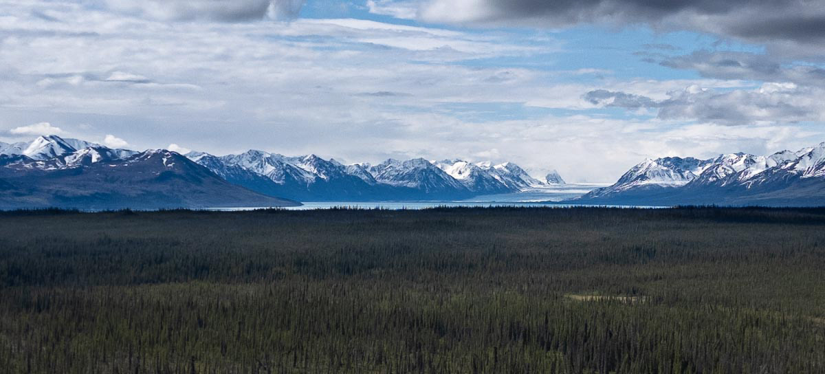
After a few days in Chugach State Park near Palmer, I headed to Glenallen which was my base for exploring McCarthy and Wrangell-St. Elias National Park. I did not have glacier viewing on my list of things to see, but when the Matanuska Glacier pops up on the horizon, it was worth a few photos (above and below) from three different perspectives.
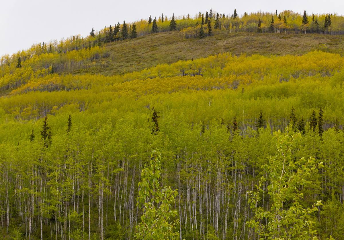
One cool surprise was the color of the emerging aspen and birch trees along the Glen Highway. The leaves are greenish, but the stands have an almost fall look of yellow when viewed as a whole.
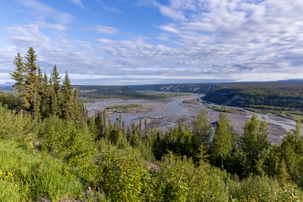
Copper River drainage at the beginning of the McCarthy Road. Winter ice and snow carve these glacier-fed river basins wide, leaving miles of exposed rock and gravel when the waters subside in the summer.
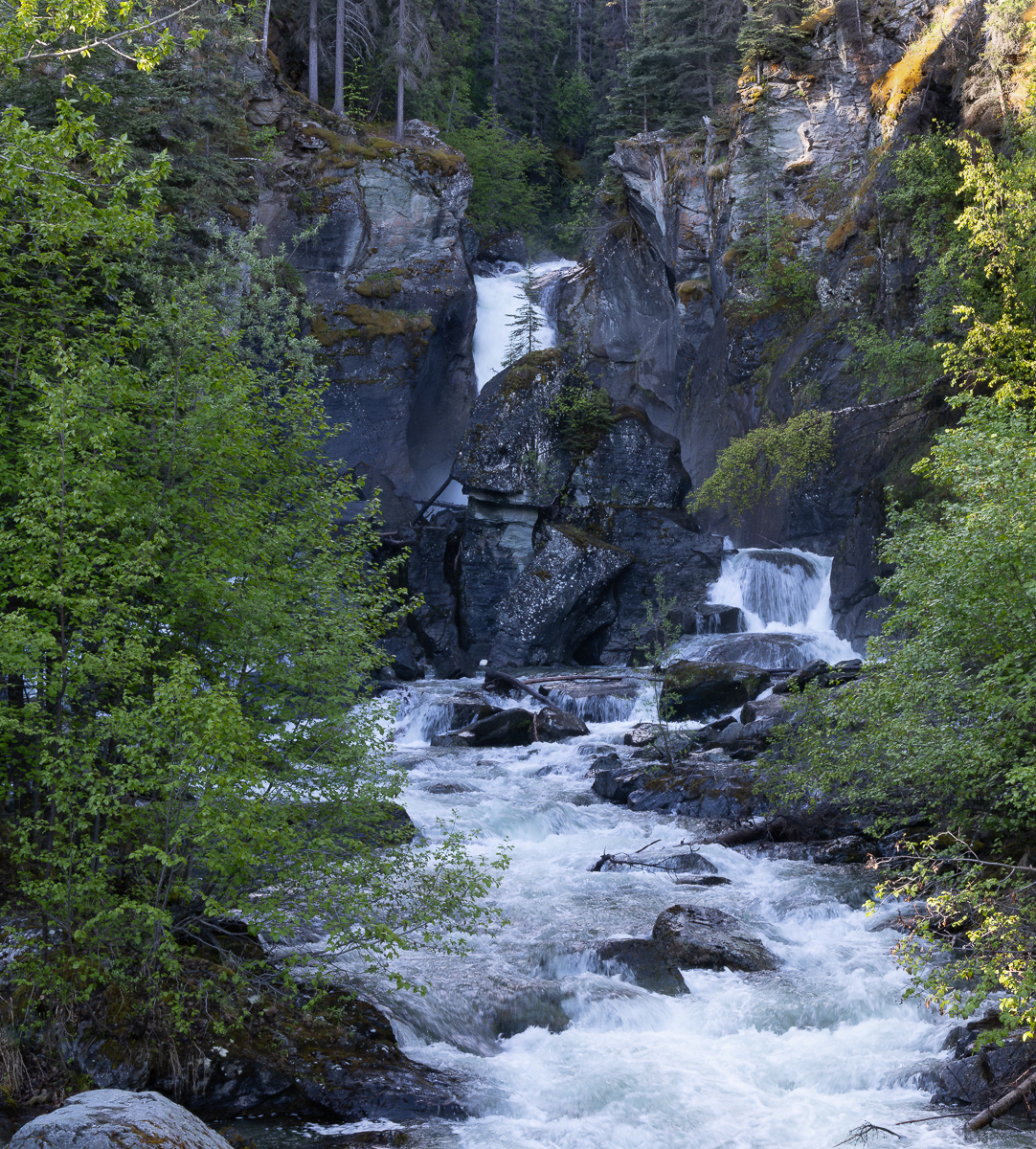
A wonderful surprise -- not on any maps or guides I had was Liberty Falls at the beginning of the McCarthy Road.
I have to add a bit of disclaimer here. Most folks drive or fly into McCarthy Alaska to visit the historic Kennecott Copper mine works at the end of the road. This mine was one of the largest deposits of copper in the world when discovered in 1904. The Kennecott Copper Corporation was formed to extract the copper oar, bag it, and ship by rail and ship to Tacoma, Washington for final refining. The McCarthy road is the original Copper River and Northwest RR (CR&NWRR) line ran 168 miles from McCarthy to Cordova, AK.
Today, only 68 miles of the original rail right-of-way exists as the unpaved McCarthy Road from Chitina to McCarthy. It is unpaved and closed in the winter.
I did not spend much time at the mill site above McCarthy. I was more interested in the journey to McCarthy and the town itself and its history. To learn more about the mine visit: https://www.nps.gov/wrst/learn/historyculture/kennecott-mines-national-historic-landmark.htm
Overall, I was disappointed in my drone video footage -- I realized I should have practiced more with the drone before the trip. Our son, Kevin, rescued me by taking my miserable clips and putting them into this neat video of the McCarthy Road. The bridge in the video is the current road bridge over the Kuskulana River. It replaced the original railroad trestle. The camper crossing the bridge is not mine. I did not come prepared to camp on this trip.
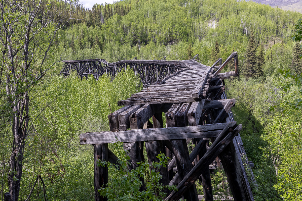
Original Copper River and Northwest RR trestle over the Gilahina River about 55 miles up the McCarthy Road.

Crystal Lake in Wrangle St. Elias National Park and Preserve

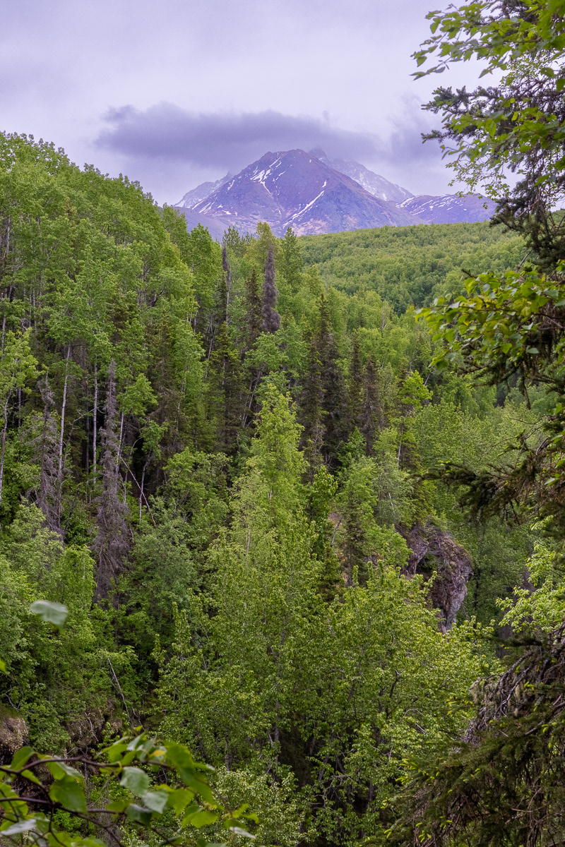
Wrangle Mountains, Alaska

The last mile of the McCarthy Road. Mine tailings appear (tan soil in distance). McCarthy residents have consistently voted NOT to build a vehicle bridge into the town over the Kennecott River. For years, folks crossed the river on a cable cart, drawn hand over hand. The original railroad bridge washed out and rebuilt every spring by the railroad. Today, there is a steel footbridge built by the NPS into town. One must park their vehicle and walk into town. There is a shuttle service from the town up to the mine.
For more of my Alaska Odyssey, please visit the next gallery Alaska Week Two 2025.